BritishColumbia.A2004316.1845.367_th.jpg
0 x 0
JPEG
0 x 0
JPEG

900 x 1200
614 KB - JPEG
3600 x 4800
5 MB - JPEG

1800 x 2400
2 MB - JPEG
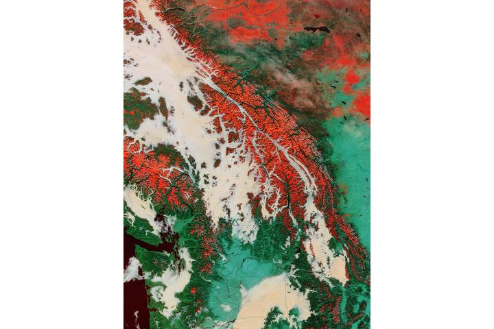
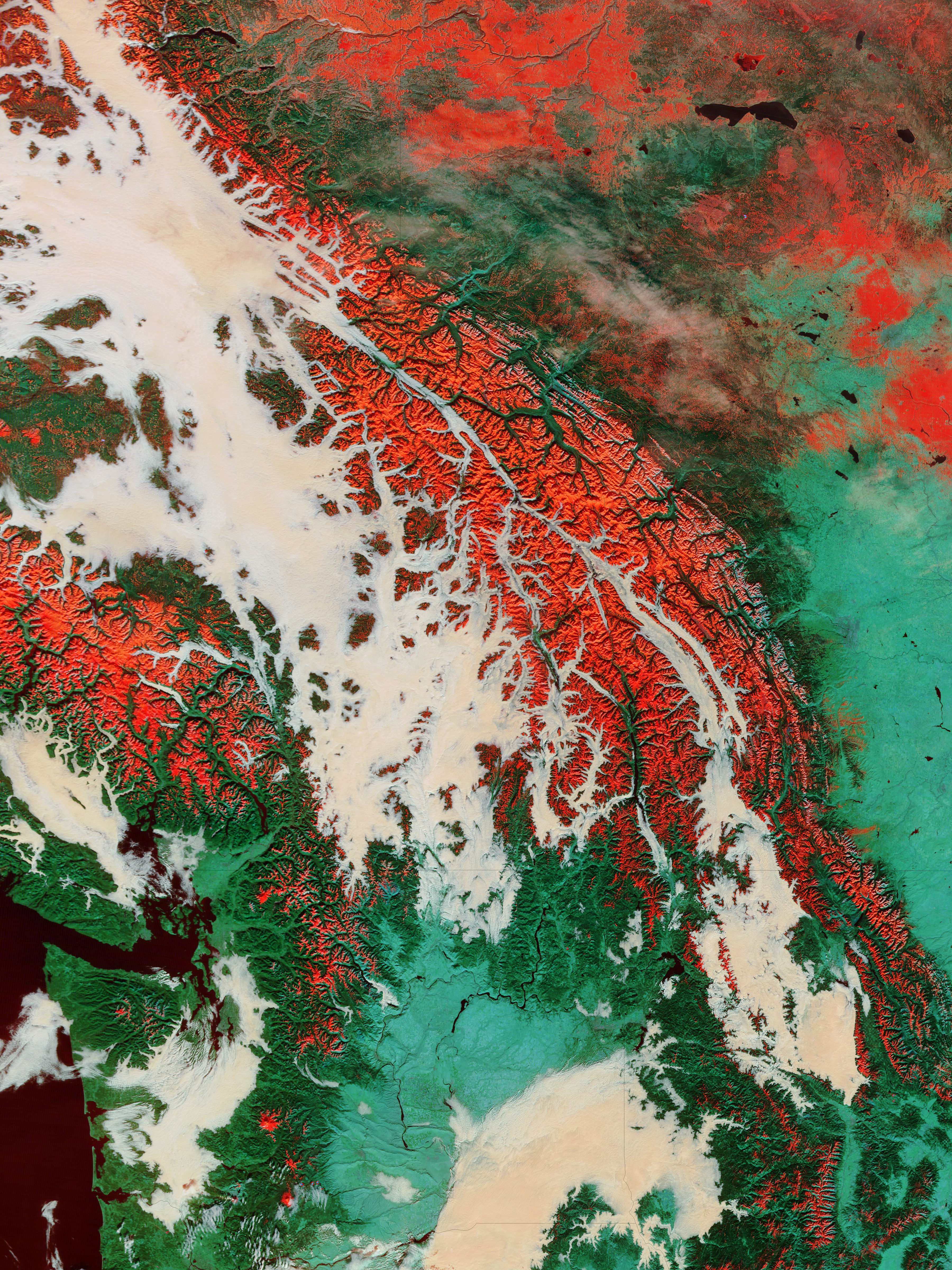
Fog and snow in the Pacific Northwest (false color)
Fog and snow in the Pacific Northwest
(false color)
region: NA
British Columbia Alberta Washington Idaho Montana United States Canada
sat: Terra
projection: Plate Carree
projection center lon: -119.0000
projection center lat: +51.0000
image center lon: -119
image center lat: +51
UL lon: -125.2942
UL lat: +56.3953
UR lon: -112.7023
UR lat: +56.3953
LR lon: -112.7023
LR lat: +45.6034
LL lon: -125.2942
LL lat: +45.6034
UL easting (km): -449.8750
UL northing (km): +6270.8750
x scale factor: +0.6427876096865394
ellipsoid: WGS84
Contact: Jeff Schmaltz
L2 granules: T043161840 T043161845
Images by the MODIS Rapid Response team.
Published November 11, 2004
Data acquired November 11, 2004
- Source:
- Terra > MODIS
- Collection:
- Rapid Response Gallery