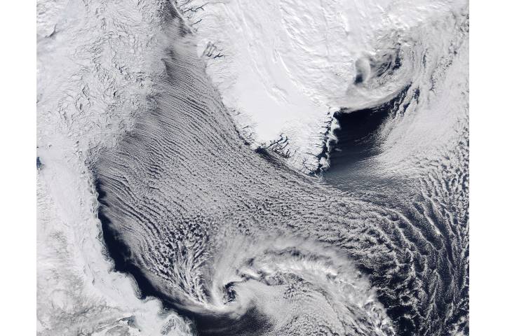
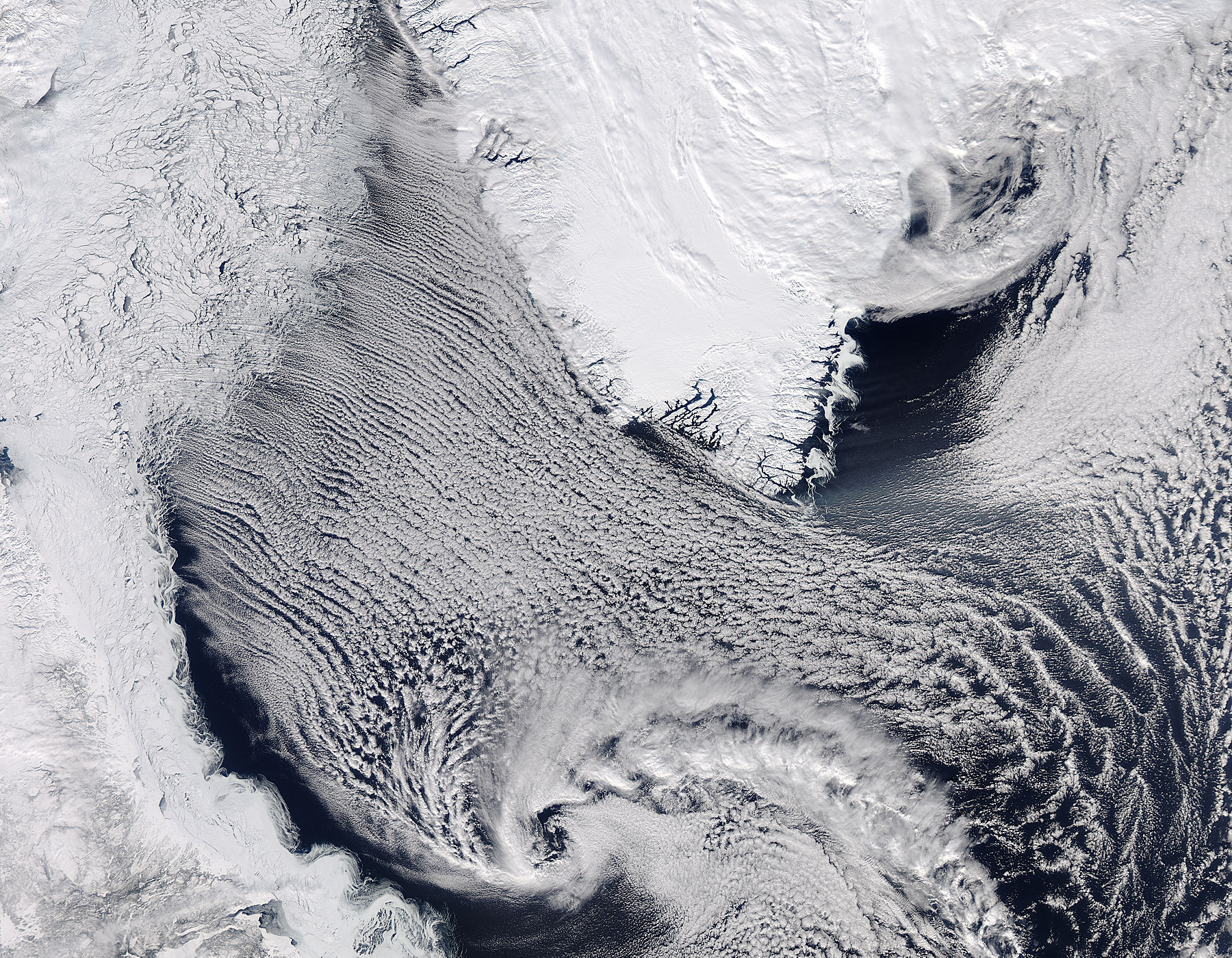
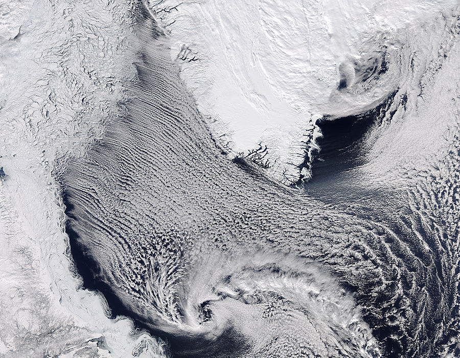
Data acquired March 26, 2014
900 x 700
273 KB - JPEG
0 x 0
JPEG
1800 x 1400
1 MB Bytes - JPEG

7200 x 5600
9 MB - JPEG
900 x 700
273 KB - JPEG

3600 x 2800
4 MB - JPEG
Cloud streets in the Labrador Sea
Cloud streets in the Labrador Sea
region: At Ar
sat: Aqua
projection: Plate Carree
projection center lon: -48.0000
projection center lat: +60.0000
image center lon: -48
image center lat: +60
standard parallel: +60.0000
UL lon: -64.1855
UL lat: +66.2945
UR lon: -31.8100
UR lat: +66.2945
LR lon: -31.8100
LR lat: +53.7041
LL lon: -64.1855
LL lat: +53.7041
UL easting (km): -899.8750
UL northing (km): +7371.6250
x scale factor: +0.5000000000000001
ellipsoid: WGS84
Contact: Jeff Schmaltz
L2 granules: A140851545 A140851550
Images by the LANCE/EOSDIS Rapid Response team.
Published March 26, 2014
Data acquired March 26, 2014
- Source:
- Aqua > MODIS
- Collection:
- Rapid Response Gallery