Irma.A2017254.1630_th.jpg
0 x 0
JPEG
0 x 0
JPEG
1600 x 2100
841 KB - JPEG

6400 x 8400
7 MB - JPEG

800 x 1050
230 KB - JPEG
3200 x 4200
3 MB - JPEG
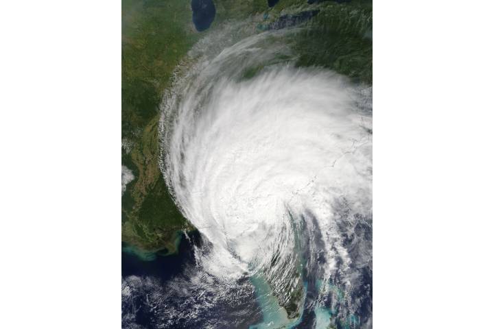
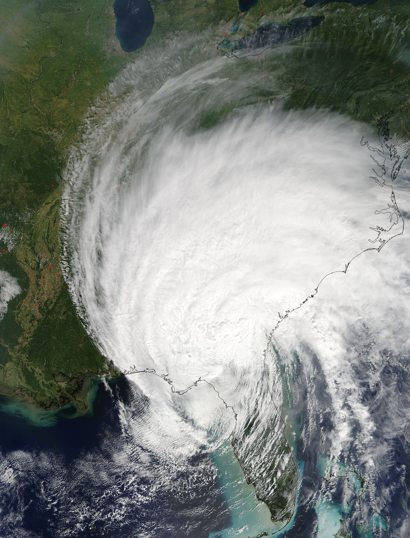
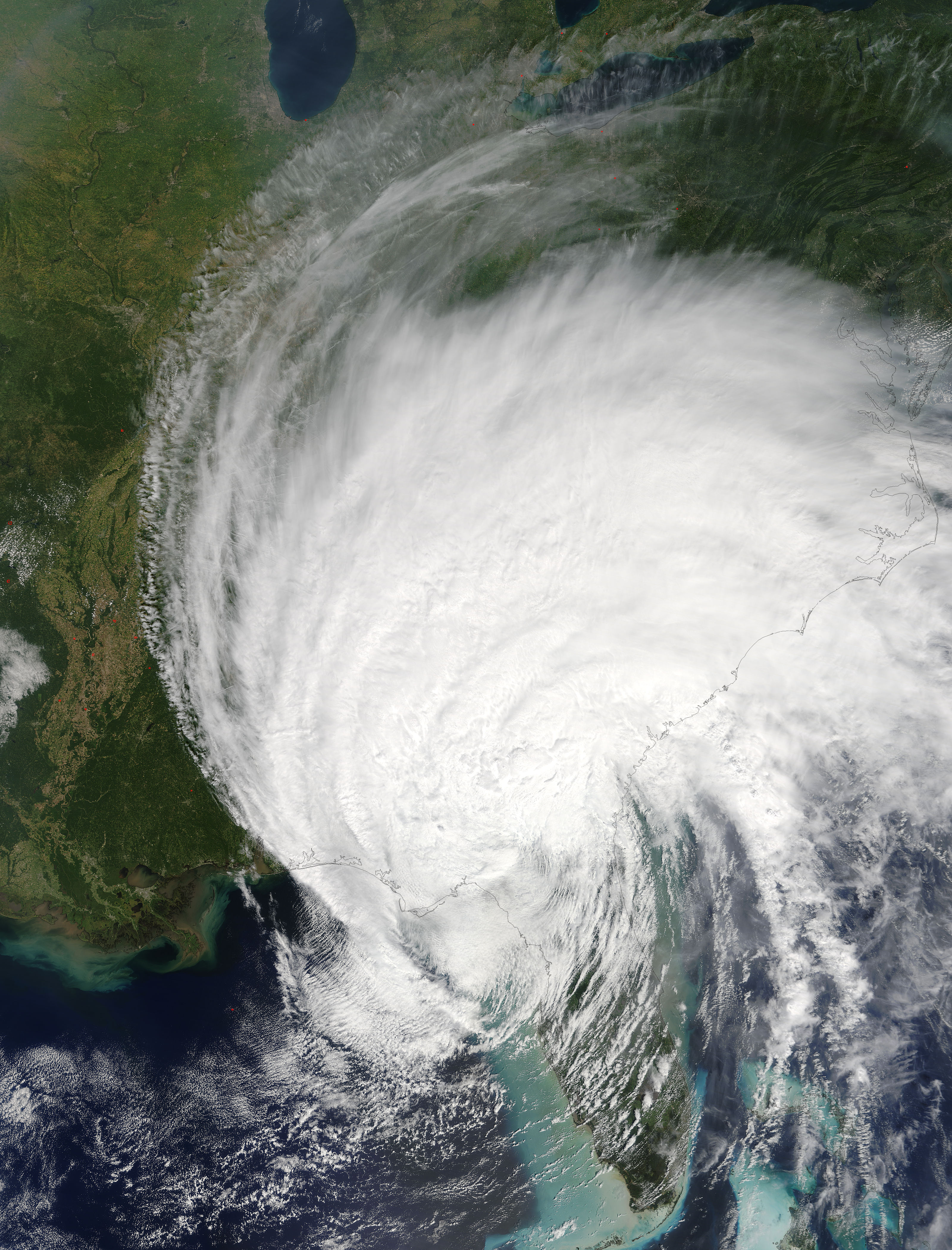
Tropical Storm Irma (11L) over southeastern United States
Tropical Storm Irma (11L) over southeastern United States
region: NA
sat: Terra
projection: Plate Carree
projection center lon: -84.0000
projection center lat: +34.0000
image center lon: -84
image center lat: +34
standard parallel: +35.0000
UL lon: -92.7816
UL lat: +43.4428
UR lon: -75.2157
UR lat: +43.4428
LR lon: -75.2157
LR lat: +24.5571
LL lon: -92.7816
LL lat: +24.5571
UL easting (km): -799.8750
UL northing (km): +4830.6250
x scale factor: +0.8191520442889918
ellipsoid: WGS84
Contact: Jeff Schmaltz
L2 granules: T172541625 T172541630
Images by the LANCE/EOSDIS Rapid Response team.
Published September 11, 2017
Data acquired September 11, 2017
- Source:
- Terra > MODIS
- Collection:
- Rapid Response Gallery